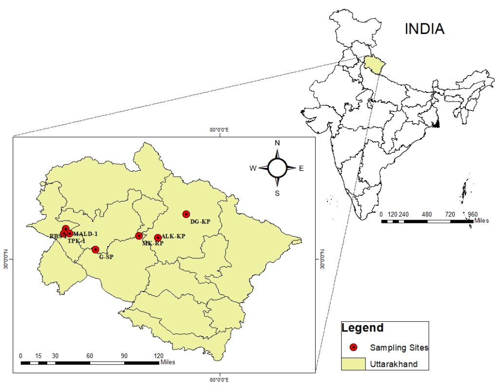
We specialize in customized map creation using ArcGIS for research, planning, and data visualization. Our mapping services include:
✔ Index Maps – Easily reference spatial data for your project.
✔ Thematic Maps – Visualize environmental, geographical, or demographic data.
✔ Geospatial Analysis – Advanced GIS-based spatial data interpretation.
✔ High-Resolution Maps – Publication-ready maps tailored to your requirements.
🚀 Get accurate and detailed maps for your research or business needs!